
PARADE TRANSPORT INFORMATION
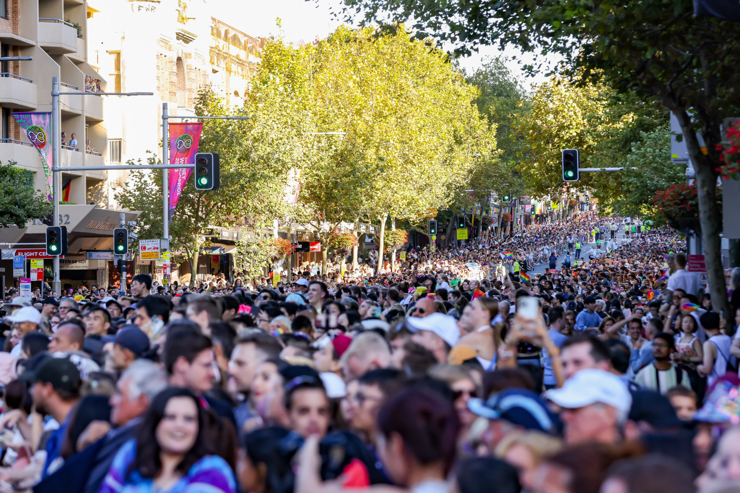
With major road closures in place and extra services running, public transport is the only way to travel to the Sydney Mardi Gras Parade. Large crowds are expected so please leave the car at home and plan your trip to and from the city ahead of time and consider all available travel options.
Transport services will be affected by road closures and crowds throughout the night. The way you arrive during the day may be different to the way you leave after the Parade. Please be patient and follow the directions of our friendly volunteers and wayfinding staff on site.
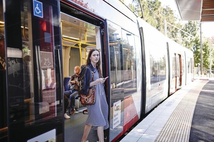
Travel on public transport is not free on Mardi Gras night, remember you’ll need to use an Opal card or contactless payment method when travelling on public transport. Remember to tap your Opal card or major debit/credit card on and off when using public transport.
Transport NSW Contact Info
If you have specific transport questions, you can contact Transport NSW on:
- Main phone: 131 500
- Translating and Interpreting Service (TIS): 131 450
- Teletypewriter (TTY) Service: 1800 637 500
The Transport NSW website features trip planners with maps and journey details, including information on accessible travel on public transport.
Train Travel
- If you are travelling by train, please check that the arrival and departure stations have facilities that meet your access needs.
- Museum Station will be closed from 5pm on Saturday 2 March until 4am on Sunday 3 March.
- To access the southern side of the parade route, use Central Station. For northern side access, use Town Hall, St James, Martin Place or Kings Cross stations.
- All patrons who register to the Accessible Viewing Area must alight the train at Central Train Station in 2024. From Central Station you will then be able to transfer to alternate public transport services or the free Mardi Gras accessible shuttle bus service.

Bus Travel
- The closest bus stops to the parade are at Central Station or QVB Town Hall.
- Additional services to the city will run from 3pm, with extra late night buses running to get you home. More details on these services will be available on the Transport NSW website.
- Be aware that buses will be affected by major road closures and will be diverting from their regular routes from 3pm.
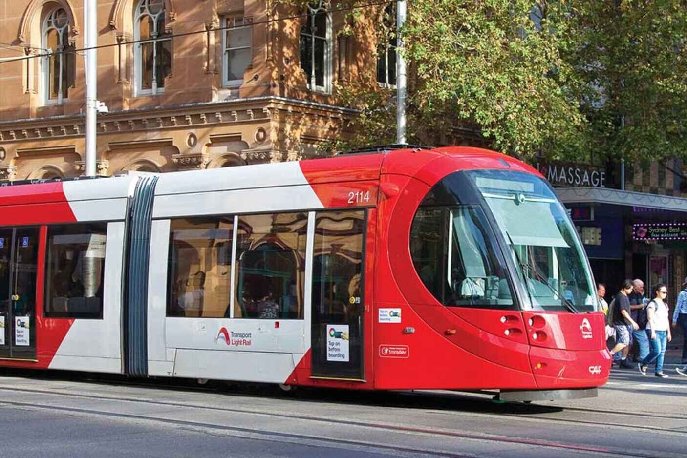
Light Rail
- For Parade viewing at Moore Park, use the Moore Park light rail stop.
- L2 Randwick services between Randwick and Circular Quay and L3 Kingsford services between Kingsford and Circular Quay and run frequently until late.
Accessible Taxis, Rideshare & Drop-off Zone
- The large crowds and road closures around the Parade footprint can make it challenging for taxis and rideshares to safely drop-of and pick-up passengers in certain areas of the City, particularly around Darlinghurst and Surry Hills. An accessible taxi/rideshare drop-off and pick-up zone will be available on the corner of Albion and Bourke Streets, Surry Hills.
- Taxi and rideshare companies will not be able to take booking requests for pick-up in areas where there are road closures.
- If you are located in metropolitan Sydney, Wheelchair Accessible Taxi (WAT) bookings can be made in advance via Wheelchair Book & Ride. If you are located outside of metropolitan Sydney, please contact your local taxi operator.
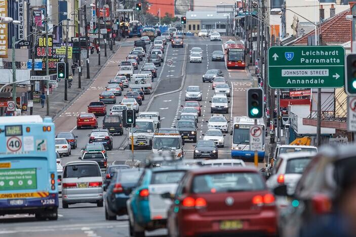
Road closures
-
- Major roads along and surrounding the parade route from the CBD to Moore Park will close from 3pm on Saturday 2 March 2024 and remain closed until 3am Sunday 3 March 2024.
- Motorists are urged to avoid unnecessary travel in the CBD and to expect delays as traffic will be heavy on detour routes.
- Large crowds are expected so leave the car at home if you intend to view the Parade.
Key road closures
-
- From 3pm to 12am midnight: sections of College St, Wentworth Ave and surrounding local streets.
- From 3pm to 3am: sections of Bourke St, Campbell St and surrounding local streets in Surry Hills.
- From 4pm to 3am: Flinders St northbound lanes from Moore Park Rd to Oxford St.
- From 4:30pm to 12.30am: road between Elizabeth St and Albion St including Reservoir St, Commonwealth St, Campbell St and surrounding local roads. Access will be managed for residents.
- From 4.30pm to 12am midnight: Liverpool St between Elizabeth St and College St, and local streets in Surry Hills between Elizabeth St and Riley St
- From 4.30pm to 3am: Oxford St between College St and Darlinghurst Rd, sections of Crown St, sections of South Dowling between Oxford St and Fitzroy St, and southbound Anzac Pde from Moore Park Rd to Lang Rd, including the Eastern Distributor Randwick Anzac Pde off-ramp (Bondi exit remains open).
- From 6.30pm to 1am: Moore Park Rd westbound from Oatley Rd to South Dowling St, and Driver Ave between Lang Rd and Moore Park Rd (until 10am Sunday).
- From 9pm to 11.30pm: sections of Elizabeth St, Castlereagh St and Pitt St between Market St and Goulburn St will close to allow crowds to safely leave the CBD.
For detailed closure and clearway listing and maps, visit Live Traffic NSW
Parking & clearways
With carparks in the city expected to fill early and extensive restrictions on street parking in place, it’s best to leave the car at home and take advantage of the additional public transport services running to get you to and from Mardi Gras celebrations.
If you have to drive and park your vehicle, be aware that roads may close around your parked location. Vehicles are not permitted to drive on closed roads or exit car park driveways onto closed roads at any time unless at the direction of NSW Police.
For parking options in the Sydney CBD visit City of Sydney – Parking.
Special event clearway parking restrictions will be in effect from 6am on Saturday until 3am on Sunday on various key roads along and surrounding the parade route in the Sydney CBD, Surry Hills and Moore Park.
Clearways are strict no-parking zones and apply to all vehicles, including local residents and TfNSW Mobility Scheme Permit holders. Check signs carefully, especially the night before the event, as clearways come into effect early on Saturday morning. Vehicles left in clearways will be towed and a fee applies. If your vehicle is towed, you can search your vehicle registration at the Find My Car website to find its new location, or alternatively call 132 701 to speak to an operator.
For the latest traffic conditions, listed clearway locations and maps, visit Live Traffic NSW.
Walking and Pedestrian Access
- The Parade Pedestrian Map to plan your walking routes from key public transport hubs to the Parade Route will become available in late January 2024.
- Pedestrian crossing points will be in place along the parade route from 4:30pm until 7pm. These crossing points will be located on Oxford St and Riley St, Oxford St and Crown St, Flinders St and Albion St, and Anzac Pde and Moore Park Rd. After 7pm, you will not be able to cross until the parade has finished. NSW Police Force may close these points earlier for public safety, so arrive early to secure a spot on your preferred side of the parade route.
- Pedestrian access to the southern side of the parade route will be via Goulburn St.
- Pedestrian access to the northern side of the parade route will be via Hyde Park South, College St and Stanley St until 6pm. After 6pm, access will be via Park St, William St and Yurong St.
- Pedestrian access for local residents and business patrons will be managed access on footpaths at Liverpool St, College St, Wentworth Ave and southern side of Flinders St. NSW Police Force or Event Security may close these footpaths at certain times for public safety.
- For the safety of spectators, crowd control barriers will be in place around the set-up area and the parade route from 6am.
- To help minimise the impact on residents and businesses in the area, we are continuing the implementation of our wayfinding staff and volunteers in the streets surrounding the Parade. This zone will have an enhanced police presence and strict enforcement of the alcohol-free policy.
- Please note that depending on crowd capacity, audience will be redirected to a different viewing location from their intended location by NSW Police Force or our security wayfinders. Residents and business patrons may also be redirected to take a different route.
Bicycles
- Major cycleways in the city centre will be closed as major roads begin to close for safety throughout the day of Parade. Bicycles are not permitted within road closures.
- To assist with pedestrian movement, bike share operators will remove the bikes from the precinct prior to the event. Bike share operators will geofence a bike-free zone within the high pedestrian areas from 2pm Saturday 2 March until 3am Sunday 3 March 2024.
- Don’t drink and ride. People riding bikes face the same alcohol restrictions as drivers.
Mardi Gras Accessible Transfer Services
We provide various transfer services to registered guests with accessibility needs to help them travel to their Parade viewing area. These services include:
- Accessible Shuttle Bus Service from Central Train Station to close proximity of the Accessible Viewing Area
- Accessible Buggy Service – to assist with travelling from the Shuttle Bus drop-off to the Accessible Viewing Area
- Accessible Parking – please note spaces are limited.
These services are available to:
- Registered guests to the Parade Accessible Viewing Area
- Any Parade viewing area ticketholders (such as Diamond Club and Sideshow) with accessibility requirements (or their companions).
If you are interested in using any of these services, you must identify this when you purchase tickets or register for our Parade accessible viewing area by 5pm, Monday 5 February 2024. Please contact us on accessibility@mardigrasarts.org.au or phone us between 10am to 6pm weekdays on (02) 9383 0900 if you have any questions or require assistance.
Accessible Transfer Services Route Map
Accessible Shuttle Bus Service
- A complimentary shuttle bus service will be available to registered guests of the Parade accessible viewing area, and ticket holders of other Parade viewing areas with accessibility requirements.
- The shuttle bus service works on a rotating loop. All buses are wheelchair accessible, and drivers will be able to assist passengers with getting on and off the bus.
- The table below details the shuttle bus operating times along with pick up and drop off locations.
- From the corner of Bourke and Albion Streets, it is approximately a 150-300 metre distance on a flat surface to the entry gates for either the Accessible Viewing Area, Sideshow or Diamond Club.
- From the corner of Bourke and Albion Streets, it is approximately a 150 metre distance on a slight incline to the entry gate for Club Cindy.
- Please note that we recommend use of the 9:30pm shuttle bus for high-needs access guests if they choose to leave the Parade early and try to avoid the large crowd when the Parade finishes.
Accessible Bus Schedule – Saturday 2 March 2024
| TIME | PICK-UP LOCATION | DROP-OFF LOCATION | |
| PRE-PARADE | 5:00PM-9:00PM | Foveaux Street Bus Stand F, near corner of Terry Street | Albion Street at the corner of Bourke Street |
| POST-PARADE | 9:30PM – 11:59PM | Albion Street at the corner of Bourke Street | Foveaux Street Bus Stand F, near corner of Terry Street |
Accessible Buggy Service
-
- A complimentary buggy service will be available to transfer accessible guests of the Parade accessible viewing area, and accessible ticket holders of the other ticketed Mardi Gras Parade viewing areas.
- The buggy service will transfer guests between the corner of Bourke and Albion Streets to the corner of Bourke Street and Linden Lane. This location is the entry gate for the Accessible Viewing Area. From this Bourke and Linden Ln location, it is:
- A 65 metre distance on a flat surface to the Diamond Club entry gate at Bourke St, corner of Campbell St.
- A 65 metre distance on a flat surface to the Sideshow entry gate at Bourke St, corner of Short St.
- Priority to this service will be given to high-needs access guests upon arrival.
- There will be two buggy carts operating on a rotating loop. This will be wheelchair accessible.
- Please note – Club Cindy guests should not use the buggy service. Instead, get off the shuttle bus and walk down Albion St towards Flinders St and cross the road to enter Club Cindy (approx. 50m)
Accessible Buggy Schedule – Saturday 2 March 2024
| TIME | PICK-UP LOCATION | DROP-OFF LOCATION | |
| PRE-PARADE | 5:00PM-9:00PM | Bourke Street at corner of Albion Street | Linden Lane at the corner of Bourke Street |
| POST-PARADE | 9:30PM – 11:00PM | Linden Lane at the corner of Bourke Street | Bourke Street at corner of Albion Street |